_________________________________________________________________________________________________________________________________________________________________________

_________________________________________________________________________________________________________________________________________________________________________ Marcy home Walvis Bay Angling Club club AFASyn Ushuaia Marcy and crew

Thursday, August 31, 2006

Santa Catalina Island, Twin Harbors, Thursday 8/31 9:00AM (Ginger)

The Oxnard stop was good for getting provisions and we met the nicest couple. Deidre and Brian took us to the farmers market where we got great produce and fresh tacos. Then Deidre took me to get an anchor at W. Marine and a huge provisioning trip at the grocery store. It had been almost a month since our trip provisioning and it was great to be able to buy the heavy stuff. They have a nicely trained 7 month old puppy and it was great to get some dog time in. They were the highlight of our visit to Oxnard. Otherwise it's an inner city stop, our shoreside bathrooms were the public park bathrooms and our boat was tied up at the park dock.
We sailed down from Oxnard Tuesday and had a sunny light wind trip. Arrived at Catalina Harbour at sunset and anchored at the entrance. It is the most comfortable anchorage we've stayed in so far. We're more protected from swell, wind and waves than we have been previously. We took the dinghy ashore and walked to Twin Harbours about 5 minutes across the isthmus. Got some gear stowage taken care of yesterday and organized provisions. A never ending process it seems.
This morning we're ashore and enjoying the patio and wireless connection at the snack bar. This place is kind of like summer camp for the whole family. We've heard it will get really busy this weekend (Labor Day) so we're not sure if we're just going to stay put or find a smaller bay to weather out the traffic. We've heard (from Ken - our Shilshole neighbor) the diving is great so we'll have to get out the snorkel gear and check out the fish.

Labels:

Monday, August 28, 2006

Enjoying SoCal! Monday 8/28 10:30 AM (Peter)

We are in a wonderful different part of the world. The weather is the expected - warmer water and air, but the animals are really different. For example, we are used to seals and sealions in the northwest, but here they surf like dolfins! They are very acrobatic and jump out of the water, dart under the boat, reversing direction in huge clouds of cavitation bubbles, darting every which way and rolling the whole time. We can see them looking at us - they are curious - but when they see us looking at them they dive instantly and come up on the other side of the boat!
pinniped off San Miguel Island 2
Dolfins Santa Barbara Channel 1
The dolfins are great fun to watch also. We've seen them nip at each other like playful dogs running in a pack. We only get them if we are sailing over 6 knots, if we slow down they go elsewhere.
Dolfins Santa Barbara Channel
palm trees
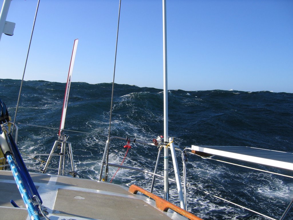
The plants are different, too. I took this picture lying down in one of the seaberths on board. We are in a boat basin "Channel Islands Harbor" for reprovisioning. There are palm trees everywhere. The boat traffic is constant. There is a very active harbor patrol who gives lots of lectures and tickets to misbehaving boaters.
Channel Islands Marina, Oxnard

Chumash paddlers 7
Crossing Santa Barbara Channel to the Harbor was a great long easy broad reach under spinnaker. We heard on the VHF that the Chumash native people were paddling a canoe to Santa Cruz, plotted their location, and realized that we could possibly intercept their intended course in midchannel. Our plotting was accurate enough, and we passed close by to take a picture. It was sobering to realize how close we had to be before we could even spot them, even though they had an escort flotilla.
spinnaker run sc island

Having the spinnaker up gave us enough speed to keep the dolfins interested. This sail really smooths out the motion. If we could do it over again, we might get a heavier one that we could fly more often. Then again, we've been told that it has been windier than usual recently here.
Peter paddling Prisoners' HarbourPeter paddling to The Irving Johnson Prisoners' Harbour 1

Another piece of equipment that has really proved itself is "Red Dogfish," our inflatable canoe. Compared to the Zodiac, it takes a fraction of the time to inflate, rig, and launch. We have even used it to set a stern anchor a couple of times, although it's a little squirrely for that service. It is big enough for both of us plus gear, but small enough to paddle alone. In Prisoner's Harbor, the "Irving Johnson" anchored near us, so I paddled over to chat.
solar panels
I realize they won't ever have better conditions than this, because it has been quite sunny, but the panels pretty much have been able to take care of all of our needs. We only have started the motor twice to charge batteries, both times for about an hour one night of heavy power usage after a few grey days as we approached the Channel Islands. There was a lot of shipping traffic so we were using the radar a lot and wind conditions were such that we needed to use the autopilot as opposed to the windvane. Otherwise, all electrical needs have been handled by the panels. This includes sailing to and off anchorages (using anchor windlass too!) without running the motor whenever we can. We also have 12 volt refrigeration and have been using the HF radio often. Our solar voltage regulator, for some reason, works fine now. It shut down and would not reset, but after a couple of days of rest, I reconnected it and it has worked fine ever since.
ginger anchor sc isl
Ginger does most of the anchor work, so I guess that makes it a pink job on Marcy.
Ginger radio
She also does a lot of the radio stuff. The radio gear has worked out well, the only real problem being an incident of user error (I forgot to update our position on the propagation calcutator) that put us of touch on the HF rig for a couple of days. There were some experts who thought that a whip antenna would not work well, but it has been great for us even at lower frequencies.

Labels:

Friday, August 25, 2006

Smugglers' Cove, Santa Cruz Island (SE corner) Thurs 8/24 4:30PM (Leigh)

Yesterday we hiked from Prisoners' Harbor to Del Norte campground . We must be a little out of practice or just anxious to see everything because we were looking for the handheld VHF radio (again) and we got a very late start. We've been lucky and happy to have lots of sun and yesterday was no different. So, mid-day hike, straight up a hill with no map and just a quick glance at the one by the trail head resulted in some hot tired hikers a few hours later. We took sandwiches, peanuts, dried fruit and (2) 26 oz bottles of water but 4 would have been about right. When we got to the campground we were lucky to see one of the endangered island foxes about 20 feet away. There were also lizards and salamanders everywhere. We had great views from the campground and I was sure the ranger station was nearby from my glance at the map the day before, so we continued up to the top of the island. Well, it turns out the ranger was another few miles toward the center of the island. We gained lots of elevation and did get a view of the south side of the island. This is very dry country and there's not much shade at 3PM here so after 8 miles of hiking we were very happy to get back to the kayak and paddle out to the boat. Peter needed to replace lost electrolytes so after several glasses of water and some canned pears it was time for sardines, saltines and beer. The snack of champions! One more search of the saloon and the VHF was found jammed behind a couple of seat back cushions! It was time to open the bottle of port and celebrate the found radio, we enjoyed chocolate and great port watching sunset from the cockpit.
Another rolly night at Prisoners' Harbor, about like Port Townsend but with ferries coming every 5 minutes. We were glad we stayed because we got a new neighbor this morning the tall ship the Irving Johnson which had just arrived after motoring all night from LA. Peter paddled the kayak over to chat. The elder hostel group was in great spirits headed ashore for a hike, the captain may have been a little sleep deprived as he wasn't in a chatty mood. We sailed to the east end of the island anchored off Scorpion Bay in strong wind and swell. Hiked up to the bluff above the boat for a photo op and took in the scene. This must be the big Channel Island destination. There were about 75 people all over the beach kayaking, swimming, hiking and hanging out. We haven't seen so many people since Santa Cruz the city. Late afternoon we headed around the corner to the lee of the island. The swell is breaking in great waves on the beach. Some surfers got dropped off by a ranger a few minutes ago so this must be the place! We're watching the waves break, sipping wine and enjoying cheese and crackers. We weren't expecting beaches like this until Mexico.

Labels:

Tuesday, August 22, 2006

Santa Cruz Island, Prisoners' Harbour Aug 22, 2006 -1700hrs (Leigh)

On our last night before we arrived at the Channel Islands we had visitors, probably dolphins, surfing our bow wave for at least 20 minutes. We could see their glowing trails in the phosphorescence as they shot toward the bow to surf the wave. It was nice to have a diversion in the middle of the night. It made me wonder how many other nights we had visitors but couldn't see them or hear them over the normal ocean noise. As we got close to the islands we were greeted by seals. They're energetic and friendly here. They would surf our wake, swim next to us and then jump out of the water or just stick their head out to check us out. Great to see friendly sea life.
Last night was our first "can in pan" dinner. Peter said it was great. He just doesn't know about my early childhood glop training! We've been enjoying the sun and warm water now that we are officially in S. Cal. I swam yesterday and today. The water is great for cooling off but not quite tropical yet. We did see some Manta Rays as we paddled back to our boat this afternoon. The activities planned for tomorrow are a hike to the ranger station and campground (7 mi. round trip - toward the east end of the island) and more swimming if it's sunny. (Now this beats a day at the office compared to those night watches on the trip to get here!) It was interesting to arrive here at noon because there was a flurry of activity as the arriving people and supplies were loaded off the parks department boat and the people who were ready to leave the island were picked up. They use a crane to load all of the gear in huge canvas totes, big enough to hold a couple of motorcycles, and then the people climb down the ladder on the side of the pier and jump on to the boat. It requires skill from the captain as they didn't tie to the dock and, obviously, agility from the passengers. There's also a concessionaire who transports people between islands for camping etc. As soon as those boats were gone the island residents (Navy, National park rangers and Nature Conservancy people) all drove their trucks away and left us and the 3 other boats at anchor. It has been a great visit, we don't expect to have this much privacy as we head toward LA and San Diego! We might head over to Anacapa Island in a day or two. We heard "Frenchy's Cove" is supposed to be good for snorkeling and diving.
We've had trouble with radio propagation in the last couple of days but Peter updated his propagation program for our latest location and hopefully it will get easier. We actually have very limited phone service here but radio still seems to be our best bet.

Labels:

Mon 8/21/06 1330hrs Santa Cruz Island 34 degrees 2 min N, 119 degrees 42 min W (Peter)

We had a nice 2 day sail from Santa Cruz the city on mainland California to Santa Cruz Island south of Santa Barbara. The winds were a steady 10 or 20 kts going our way the whole way - we ran wing and wing for 20 hours or so. As we approached Pt Conception it breezed up as expected, and the last 8 or 10 hrs was under double reefed main alone. We found a nice anchorage yesterday afternoon in a little nook on the north shore, Pelican Bay, and dropped anchor under sail. Under sail because as we approached, when we tried to crank the engine, nothing happened. We were able to position ourselves pretty well under sail, but ended up a little too close to a small sloop anchored near the center of the cove. As long as the wind blew, we were separated enough, but at around bedtime the wind dropped and we got way too close. The people on "Lady Grace" were very nice and shortened up their scope to keep clear. The next morning they gave us some tips on places to explore in the Channel Islands, and took off. We spent the morning trying to figure out the problem with the motor. We fixed it at noon (salt water on a terminal block) and are now going to pump up the dinghy and go exploring. The sun is out, the water is warm, the motor runs, and life is good!

Labels:

Saturday, August 19, 2006

Heading South - 70 miles North of North Channel Islands lat 35 deg 01.74'N long 121 deg 51.82' W Sat 8/19 1:50PM (Leigh)

We left Santa Cruz just before noon yesterday and started sailing south headed for the Channel Islands. It was great to be on shore and do normal shore things. Most of our time was spent working on the boat and at the coffee shop with free wireless access. There are even new photos posted (Niemann Photos button at right - "The voyage" folder).
I decided the anchorage was too iffy at Monterey and the aquarium was pretty far from the anchorage and marina so we skipped Monterey. We sailed out of Monterey Bay and only had to tack once to clear the Southern point. Peter was kind enough to alter our watch schedule by 2 hours this trip so he was on 6PM - 10PM. When I came on watch the phosphorous was beautiful. All around us the wind wave tips were glowing and our wake had a deep green glow that trailed us by 30 feet. It was a cloudy night but the clouds would clear in small patches revealing thousands of stars. I never saw the moon which made the phosphorescence more dramatic. The wind had been shifty on Peter's watch and we were headed down wind at about 4.5 knots. Soon after I came on watch the wind picked up and we were making great time at 6.5 - 7 knots on a beam reach with a reef in the main to make it smoother. An hour into my watch I saw a ship on the horizon. I turned on the radar (this time I was ready, much better than last time but that's some sleep Peter lost one night last week) and saw that the ship was headed right for us at 20 knots. It was hard to figure out which way they were going as they kept changing course slightly, but they were definitely getting closer fast. When their course finally settled down our CPA (closest point of approach) was 27 feet! After a couple of minutes I woke Peter up because we were under sail and I couldn't just steer away from the ship without adjusting sails. By then they were 7 miles away and pointed directly at us with both red and green lights clearly visible. Fran is a great teacher and I've needed much of her advise so far on this trip, as she taught me, I got on the radio and called twice but there was no response. Peter and I were back on deck removing preventers and the running back stay preparing to jibe when there was a garbled response on the radio and the ship altered course. Not sure if the radio call got his attention or if he finally just saw us. We heard him calling San Francisco pilot for the next few hours with no answer so he wasn't having much luck with radio response either. We're still looking for our hand held radio after we misplaced it in that storm last week. One of these days it will show up where we least expect it. We're keeping the boat much neater now, it's great for discipline living in moving house.
Considering we're in a major shipping area we really haven't seen many ships and for the most part we've stayed well out of their path. A flashlight shining on the sail is an impressive lantern at night and that is our low tech "here we are" warning.
We're still sailing down wind. Now we've got the jib poled out and we're sailing wing and wing and going about 5 knots. The swell is directly behind us and it a fairly comfortable if not rolly ride. Still overcast and we're looking for that sunny weather for which this state is so famous.

Labels:

Thursday, August 17, 2006

Shore leave! Santa Cruz (Leigh)

It's great to be on land. Showers, internet access and it's nice to get my appetite back. We drifted around all night off San Francisco Bay and the next day decided it was time to come in and get a new water pump. The old raw water pump was pumping a few gallons of salt water into the boat every hour that we motored. Actually even when we weren't motoring water was coming in if the seacock was open.
We've walked around Santa Cruz, checked out The Boardwalk (busy carnival scene that was definitely sensory overload) and walked through the downtown area. Got our bikes out yesterday and rode to a grocery store for some supplies. Erin came down from SF and had dinner with us. It was a long drive for an evening but it was great to see her and she brought us some cheese from her new job. Looking forward to tasting that this afternoon. Peter is picking up the new water pump (came UPS from Florida) so we have our fingers crossed that it will be the right one. As soon as it's installed we can head south again. I'm hoping for light wind because if it's slow going today we might just go to Monterey and then we'll probably go ashore tomorrow to see the aquarium. So, if cruising is "fixing your boat in exotic places"then we're officially cruising now and it's great.
We're still figuring out the blog posting and putting new photos on flickr. They've been very nice to us as we've spent a few hours at a coffee shop trying to get things updated.
Peter calls me Ginger these days - nothing to do with the ss Minow, more to do with the fact that my name is really bad over the radio. I've had too many conversations where I say "this is Leigh" and people say back "me who?" So, we'll see if Ginger sticks..

Labels:

Leaving Washington State! Peter


Here is Marcy ready for the passage south. I'm a northwest guy at heart, so I loved Neah Bay - with its grey skies, dampness and cold wind. The mood among the crews of the sailboats gathered here is something like that of a mountain climbing high camp, with nervous anticipation and excitement about the upcoming passage. We chatted with one boat we might meet in the Channel Islands, and another we might see in Mexico. We shopped in the little groceery store (with suprisingly good produce!) and visited the excellent Makah Cultural Center. We saw three beautifully crafted replica log canoes, as well as artifacts from the Ozette dig. The Makah certainly are are artistic and skilled woodworkers.


As we cleared the coast the next morning, the wind was light to nonexistant. When we set sail, the slatting and slamming of the rig exposed a weakness in the mast step. The point of attachment where the vang meets the mast and step was moving around a bit. I'd like to see that area beefed up before we really stress it.


Before long a nice breeze came up, and built up into a real blow. Luckily the mast step showed more signs of stress in light wind than a strong one. This photo shows the hero of the wind - the self steering gear. Just before leaving Seattle, on the advice of dock neighbor (and circumnavigator) Jim Hartman we installed a Monitor vane. It steered perfectly for the 50 or so hours of wind that we encountered. I can't imagine hand steering even for a fraction of that time! Even though we have a nice autopilot, it was not an option during this time, because our batteries had discharged to a very low state. The solar regulator had gone offline for some unknown reason. As soon as we discovered the problem, we wired the panels direct to the batteries, but had it not been for the wind vane we would have been forced to hand steer through the whole storm!Another item that proved out was the seaberth. Here is Ginger looking happy and snug. We both looked forward to offwatch time!


The seas built up, and we got lots of water on deck. We heard a new warning on the radio for me, "hazardous seas warning." I think what that means is that because of the ratio of wave height to length a boat of about our size can expect green water on deck. The waves were steep and close together. We were hit by two big ones - the first of which occured when Ginger was in the seabunk and I was sitting on the cabin sole chatting with her. There was a deafening boom and we were both instantly hosed in jets of saltwater. We later figured out that water came in through openings in the companionway slide as well as the "flying saucer" vents. The second time I was on deck trying to figure out if there was anything to do - change course, shorten sail (by now we were under our tiny little staysail only) when we got pooped by a big one. Ginger was down below - I can't imagine what it must have sounded like. She said she look out the ports and saw green. I was in the cockpit knee deep in water, and was very pleased with how fast it drained out. Ginger popped the hatch open to make sure I was still on board.


Labels:

Monday, August 14, 2006

West of Half Moon Bay Lat 37deg 31.941' N, long 123 deg 23.173' W (Leigh)

We motored through the night and finally the wind came up just north of the entrance to San Francisco Bay. We've been sailing at about 3 knots since noon and had a chance to dry out and clean up from all the salt water a couple of days ago. The sun is almost shining now and it's great to be sailing again.

Labels:

Sunday, August 13, 2006

Sunday August 13, 2006, Ft. Bragg north of SF, CA n 39deg 24.681', W 123 deg 50.678' (Leigh)

Our plan was to head west and miss the gale forming just north of San Francisco. That would have been good but on day 2 the weather reports said our course was already experiencing strong winds and building seas. We second guessed our decision (or Peter was kind to me)and we came back in closer to shore chasing the better weather reports. (We had never before heard a "Hazardous Seas Warning," certainly not for someplace we were sailing!) That's the problem with chasing better weather, we were behind it in strong winds and big waves. It was the hardest test of my physical, mental and emotional strength I've ever been through. Our little storm was nothing compared to really bad weather, the boat never broached, we only had a few waves come over the decks and the cockpit stayed relatively dry. I just hadn't really planned on being in areas where the waves were that big.. While Peter has been tirelessly working on getting the boat ready for this trip I've been focused on saying goodbye to friends and family and getting the checking accounts in order. I was still sad about leaving Seattle and should have spent more mental energy on where we were going and what was involved in getting there. This is however the best bar none diet and exercise program I've ever been on. The appetite is gone and the physical demands have been high. No problem not having access to a yoga studio or bike yet!
Here's something else I learned, when it seems like you're landing on your head down below, go up on deck, it's amazing how this boat stays on top of very high steep waves when the water has fallen away under us.
After our overnight stop at Shelter Cove (which only provides shelter from the north) we left in a southerly wind this morning. We're motoring south and will decide in a few hours to stop in San Francisco or continue on south. Definitely looking forward to sunny skies and a couple of days to rest at a quiet anchorage. It is a huge luxury to have email and it's been great to hear from people. Thanks for staying in touch.

Labels:

Saturday, August 12, 2006

"Blast of Fresh Air" 2006 lat 41 deg,23' N long 125 deg 43'W Friday 8/11/2006 1:30 PM (Leigh)

We must truly be gluttons for punishment because here we are with 12' wind waves and 4-6' swell. But it's obvious we're in California because even on stormy days the sun shines. It is definitely challenging standing at the computer so we know we need to add a couple more handholds and I have to make a belt to hook into at the nav desk. As it is now it's an aerobic effort to type. Good thing for spell check because every wave has a different opinion of my report and what should be said! The wind is about 40 knots with higher gusts. We are getting the occasional splash on the windward side but so far no big waves have come aboard. The waves are gorgeous and mesmerizing. I've tried to take pictures but things always look flatter in a picture than in real life. We thought about getting out of the storm and found the perfect place but we only had 40 southerly miles to get 80 miles west to make the entrance to the bay. That course would have put us beam on to the waves for about 10 hours. We decided to be prudent and keep our relatively comfortable ride so we missed that bay by a lot. We're staying on a course that's closing in on land. We're about 60 miles off shore now and should clear Cape Mendocino at approx 10P or 11P tonight by 30 miles on our current heading. We've been in contact with a couple of other boats and they report that the weather is better closer to shore. It's nice to have real people backing up the computer weather reporter on VHF radio. Now I know why people talk about putting the boat away after a long passage. We have had to move clothes and snacks, handheld radio and GPS and a few other misc things to the convenience of under the saloon table. We can tell the motion of the boat is affecting both of us because Peter hardly has an appetite right now. We'll have to find a steak dinner for him when we get ashore. On the bright side we really know a lot about scop patches now: dry mouths and slightly dilated eyes (which Peter loves because even I have to wear glasses to read the computer screen). Our solar panel controller stopped yesterday or the day before and Peter was able to rewire the panels around the controller so we have full batteries again. We love those batteries!
P & L

Sat 8/12/06 - Safe and sound in Shelter Cove, south of Cape Mendocino and a couple of hundred miles north of San Francisco. What a ride! We're going to take a nap and put the boat back in order.

Labels:

Thursday, August 10, 2006

Pacific Ocean, 151 miles west of Depoe Bay, OR 17:30 (Leigh)

Sushi for lunch! Peter caught an albacore today. It was about 20 lbs and the freshest sushi I've ever had the pleasure of eating. It was a beautiful quiet night last night. Saw a lot of fishing boats off the Columbia River and were out 175 miles this morning when we finally jibed to start heading south. Happily the wind is cooperating and sending us more toward our desired course now. Sunny afternoon, light northerly winds, light swell, great sailing. The water is a beautiful blue out here. It's not the familiar green/grey of our home waters!
L&P

Labels:

Wednesday, August 09, 2006

August 8, 2006 -17:25, 100 miles off Ocean Shores 46deg 53.73'N, 126 deg 57.49'W (Leigh)

We've been at sea 36 hours now. We're settling in to our 4 hour watch routine. We saw some grey whales Monday morning, lots of sea birds and some sun fish. The night watch was far more interesting than expected. We started out with a sun set and a moon rise both drawing our attention at the same time. The clouds got thicker about 10PM so the moonlight was all but gone. We passed what looked like an aircraft carrier and it was really easy to see that in the dark. There were squid glowing in our bow wave off and on all night and at one point some porpoises scooted around our boat for about 15 minutes. It seems like there shouldn't be any traffic this far from shore but there are a lot of fishing boats out here. So, the routine is sleep, eat, watch, adjust sails etc. We talked with Kinship this morning and they are 300 miles south of us in completely calm waters with no wind. We're hoping to pass off Cape Mendocino with enough wind to keep going but clear of the gale that's showing up in the 48 hour forecast. Looking forward to sunny skies and warm waters!

Labels:

Monday, August 07, 2006

Pacific Ocean 48 11'.450N, 125 07'.725W (Leigh)

12:30 PM Monday,
We left Neah Bay as planned at 5:30AM. Some fog but relatively good visibility. Motored just past Cape Flattery, raised the main sail and motor sailed for another hour to get through the steepest swell. Multi tasking is good so we made some water while we were motoring. Shut the motor off about 8AM and we're sailing along in calm water with a small swell just to let us know we're really on the ocean. Made radio contact with Kinship. They're just approaching California and have made great time in the last 2 days. Had lunch and have been trying to keep to our watch schedule so Peter is in bed now. I think I picked the wrong watches - who doesn't want a nap after lunch! Missing our friends in Seattle but the weather is good and we're looking forward to swimming in the warm southern California waters.
L&P

Labels:

Sunday, August 06, 2006

Neah Bay, Sunday, August 6 (Leigh)

We spent 2.5 nights anchored off Port Townsend. The first 2 nights were incredibly windy, typical for that spot, and it was great for getting our stomachs and legs accustomed to the motion. We left Port Townsend at 1:30AM Saturday 8/5. The plan was to leave at about 3:30AM but we were woken by bar patrons in town and decided since we were up and there was no wind it was a great time to get going. The moon was already gone but it was a clear night with great visibility. Rounding Point Wilson we were contacted by vessel traffic control asking our intended course. They notified the cruise ships to watch out for us and seemed happy to hear that our course was actually consistent with our plan. They told us to stand by on another channel for our trip in case they needed to contact us. That's a first for us! So, our first "official" radio contact was a success. The water was relatively calm after the green water over the bow at Point Wilson, there were a lot of shooting stars and it was a beautiful night to be out. It's always good on a long trip to get some sleep so I (generously) offered to take the first shift asleep. - It was boring after a few hours and somebody needed to go to bed first! I slept for a couple of hours and woke up ready to take my turn at the helm. Peter had a short nap after setting the computer up to receive the weather fax and we motored on. We checked in by radio with Kinship. They left Neah Bay Saturday morning and were already around Cape Flattery in some big waves and fog. The last 12 miles of our trip to Neah Bay were in fog and required a close watch on the radar. Tools like that are really great to have when you need them. Arrived Neah Bay at 2:30, got fuel, and contemplated our jobs to complete before departure. We were both exhausted. Had dinner in town and decided to stay another day to finish projects and get an early start Monday morning. Went to the Makah Cultural and Research Center and are getting all the last projects wrapped up this afternoon. It's been very foggy here all day. Hopefully this will all dissipate tonight and be clear skies in the morning (hope springs eternal)
L & P

Labels: